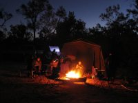
Grey nomads with pets are welcome at many NSW State Forest camping areas. PIC: Cizza
Bago State Forest – Bago Sculpture Forest – Paddy’s River Dam – Paling Yards – Blowering Dam Foreshores – Pilot Hill Arboretum – Sugar Pines.
Location: Foreshore Rd, Blowering GPS: -35.540476°, 148.260035°
Belanglo State Forest – Dalys Clearing.
Location: Dalys Rd, Belanglo State Forest, GPS: -34.527643°, 150.241341°
Bodalla State Forest – Bodalla Forest Rest Area, Kianga Rainforest Walk, Wagonga Scenic Drive. Location: Bodalla Park Rd,
GPS: -36.151320°, 150.095116°
Boonoo State Forest – Basket Swamp visitor area – Basket Swamp Falls
Location: Boonoo State Forest, GPS:-28.910180°, 152.153782°
Campbells Island State Forest – Campbells Island
Location: Murrabit VIC GPS:-35.51140856981758, 143.94973744837247
Chichester State Forest – Allyn River Forest Rest Area – Ladies Well – Pademelon – Old Camp – White Rock – Location: Allyn River Rd, Upper Allyn GPS:-32.155619°, 151.488603° NB: Peach Tree and Mount Allyn are currently closed.
Chichester State Forest – Telegherry Forest Park – Frying Pan Creek – Currawong Camping Area – Coachwood Camping Area.
Location: Middle Ridge Rd, Upper Karuah River GPS: -32.221114°, 151.745442°
Coopernook State Forest – Coopernook Forest Headquarters
Location: Bangalow Rd, Coopernook, New South Wales
GPS: -31.788881°, 152.608581°
Dog Rocks State Forest – Campbells River
Location: Swallows Nest Rd, Mount David, GPS: -33.785820°, 149.609451°
East Boyd State Forest -Scrubby Creek Rest Area
Location:Princes Highway, GPS: -37.222069°, 149.830303°
Ellangowan State Forest – Braemar Roadside Rest Area
Location: Summerland Way, Rappville, GPS:-29.088060°, 153.001973°
Girard State Forest – Crooked Creek Picnic Area
Location:Crooked Creek Fire Trail, Sandy Hill, GPS:-28.926982°, 152.312500°
Hampton State Forest – Millionth Acre Recreation Area
Location:Duckmaloi Rd, Hampton, GPS:-33.676944°, 150.050272°
Heaton State Forest – Watagan HQ – Heaton Forest Park – Heaton Lookout – McLeans Lookout – Hunter Lookout
Location: Watagan Forest Rd, Olney, New South Wales GPS:-32.975802°, 151.412148°
Kerewong State Forest – Longworth’s Tramline – Swans Crossing
Location: Swans Crossing, GPS: -31.608745°, 152.581787°
Koondrook State Forest – Murray River
GPS: -35.66800670000439, 144.246664668354
Mount Boss State Forest – Wild Bull Camping Area – Cobrabald – The Bluff
Location: Cobrabald Rd, Kippara, GPS: -31.245876°, 152.513164°
Nalbaugh State Forest – Nalbaugh Falls
GPS: -31.23992690611348, 146.91757958395064
Olney State Forest – The Basin Campgrounds – Abbotts Falls – Rock Lily – The Pines Picnic Area – The Pines, Casuarina and Turpentine Campgrounds – Old Mill
Location: Basin Forest Rd, Olney, GPS: -33.104476°, 151.230474°
Perricoota State Forest -Perricoota State Forest Bush Camping
Location: Freemans Rd, Womboota, GPS: -35.940171°, 144.479270°
Stewarts Brook State Forest – Moonan Outlook – The Firs
Location: Stewarts Brook NSW 2337, GPS: -31.93137288282747, 151.36193641023226
Styx River State Forest – Wattle Flat Picnic Area – Wattle Flat Camping Area
Location: Boundary Rd, Armidale Region, GPS: -30.584152°, 152.200199°
Sunny Corner State Forest – Sunny Corner Arboretum – Sunny Corner
Location: Sunny Corner Road, Sunny Corner, GPS: -33.387867°, 149.892964°
Urbenville State Forest -Urbenville Forest Park.
Location: Clarence Way, Urbenville, GPS: -28.468365°, 152.548682°
Vittoria State Forest – Macquarie Woods Rec Area
Location: Cashens Lane, Vittoria, GPS: -33.408018°, 149.312622°
Vulcan State Forest – Shooters Hill – Black Springs
Location: Riverview Forest Road, GPS: -33.886148°, 149.845463°
Wild Cattle Creek State Forest – Mobong Creek
Location: Moses Creek Rd, GPS: -30.218611°, 152.779190°
Wingello State Forest – Wingello HQ Camp
Location: Caroua Road Wingello, GPS: -34.715833°, 150.189104°
Yadboro State Forest – Yadboro Flat
Location: Yadboro State Forest, GPS: -35.340331°, 150.217275°
Yambulla State Forest – Newtons Crossing Camp
Location: Allan Brook Rd, Yambulla, GPS: -37.267390°, 149.674800°